(The kid in this video also starred in the movie “Hunt for the Wilderpeople.” He’s super famous in New Zealand.)
Since the majority of the world’s population lives in the northern hemisphere, there are very few holiday songs, memes or themes that feature a summery Christmas. Even if you live in Florida, Christmas is still in winter and you associate the seasonal changes of your climate even if there’s never any snow.
Sharing Christmas with things you only experience in summer (like mosquitoes, 17-hour days and berry season) is weird.
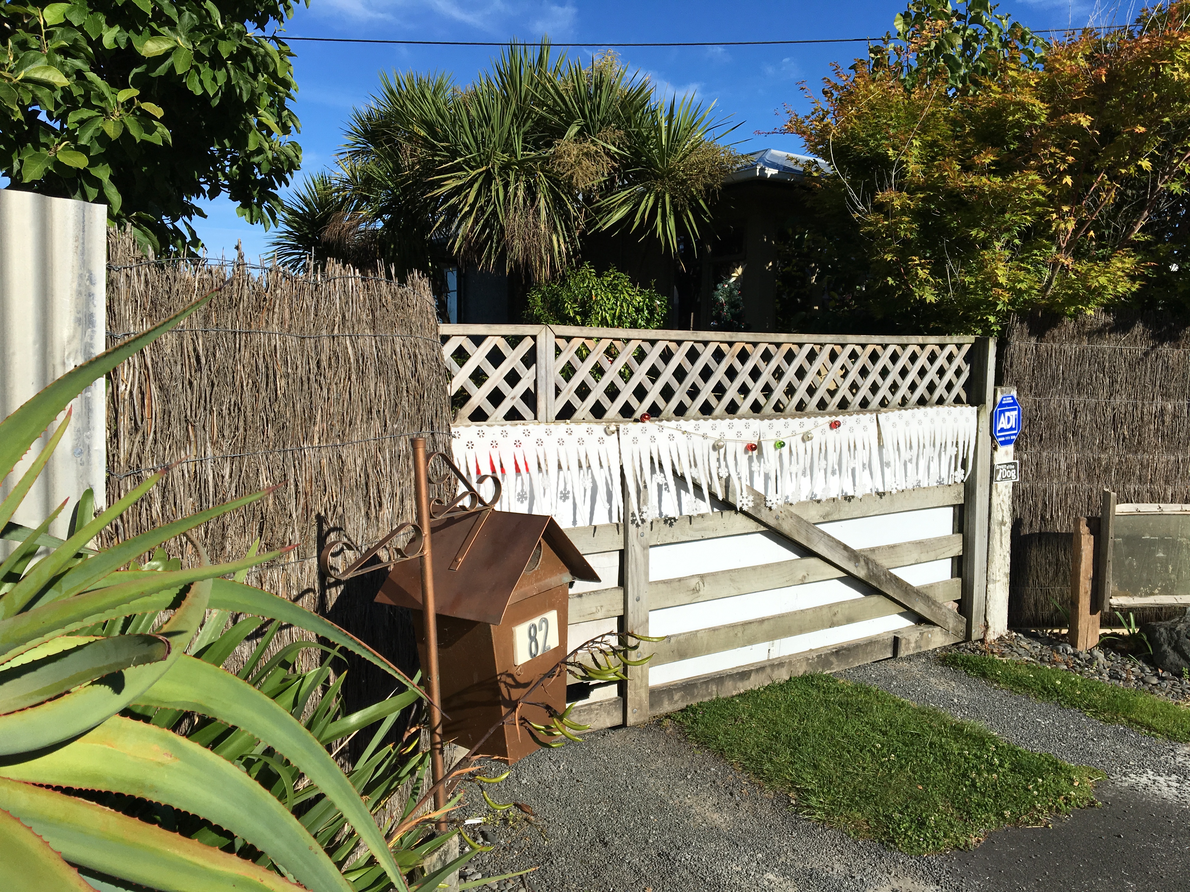
I took this photo on a run with Oma. Someone hung felt icicles on their fence line.
Coniferous trees are available, although most New Zealanders buy a plastic tree. Richard found our tree floating in the river. We decorated it with dried tomatoes, apples and grapefruit. I took some blooms off the pohutukawa tree in our yard (it’s also called the Kiwi Christmas tree) to add the pretty red flowers to our tree. Richard added some wood shavings as tinsel because we had them laying around after a window repair project.
Oma and the tree.
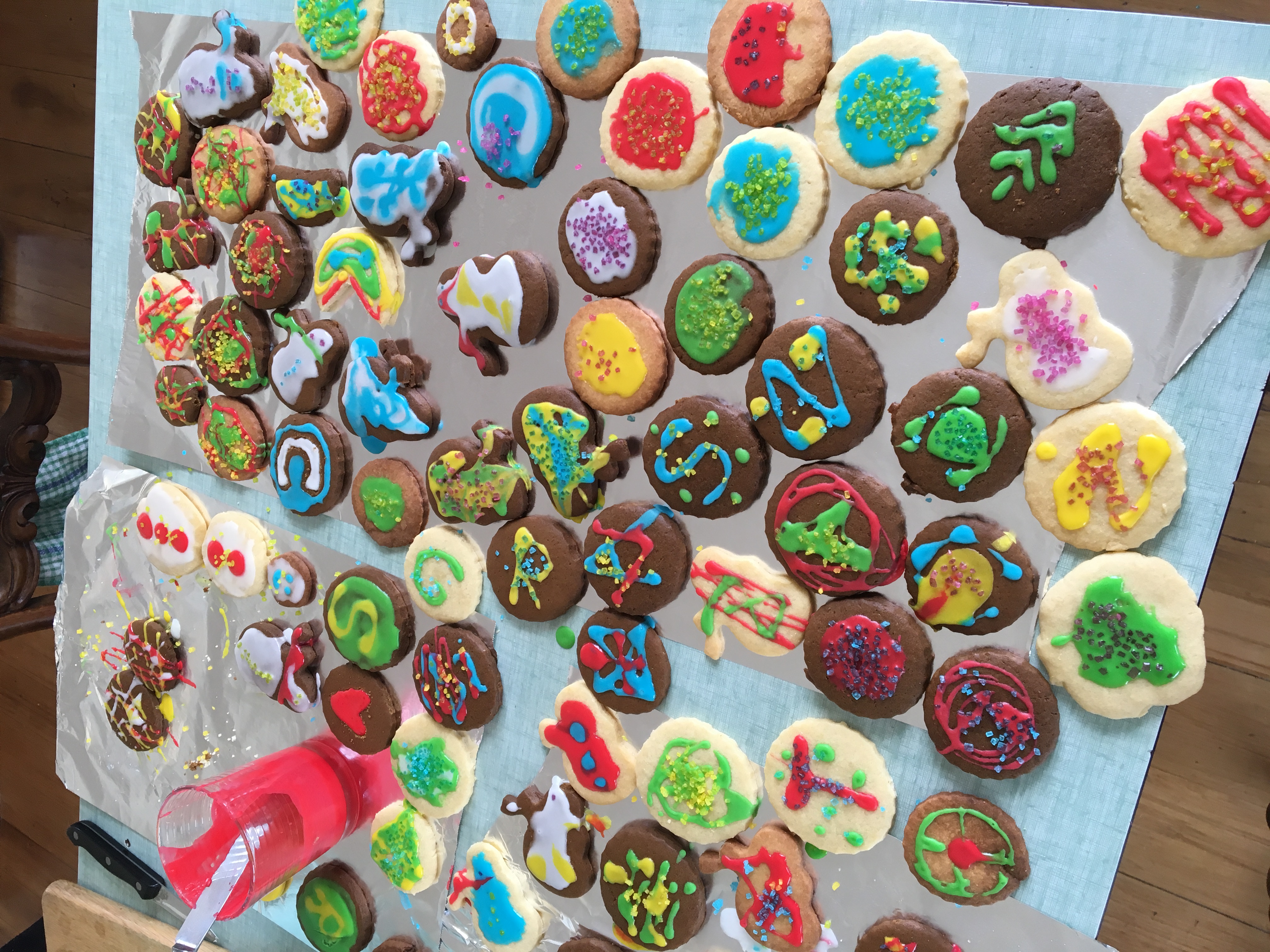
We hosted a friend who is biking around New Zealand. She and I made many, many Christmas cookies and had a blast decorating them.
So many cookies!
Then we went to dinner with the other expats who don’t have family in town.
It was an experience of haves versus have-nots, sharing of finite resources and reliving childhoods when we all played in the sandbox with kids whose names we never bothered learning.
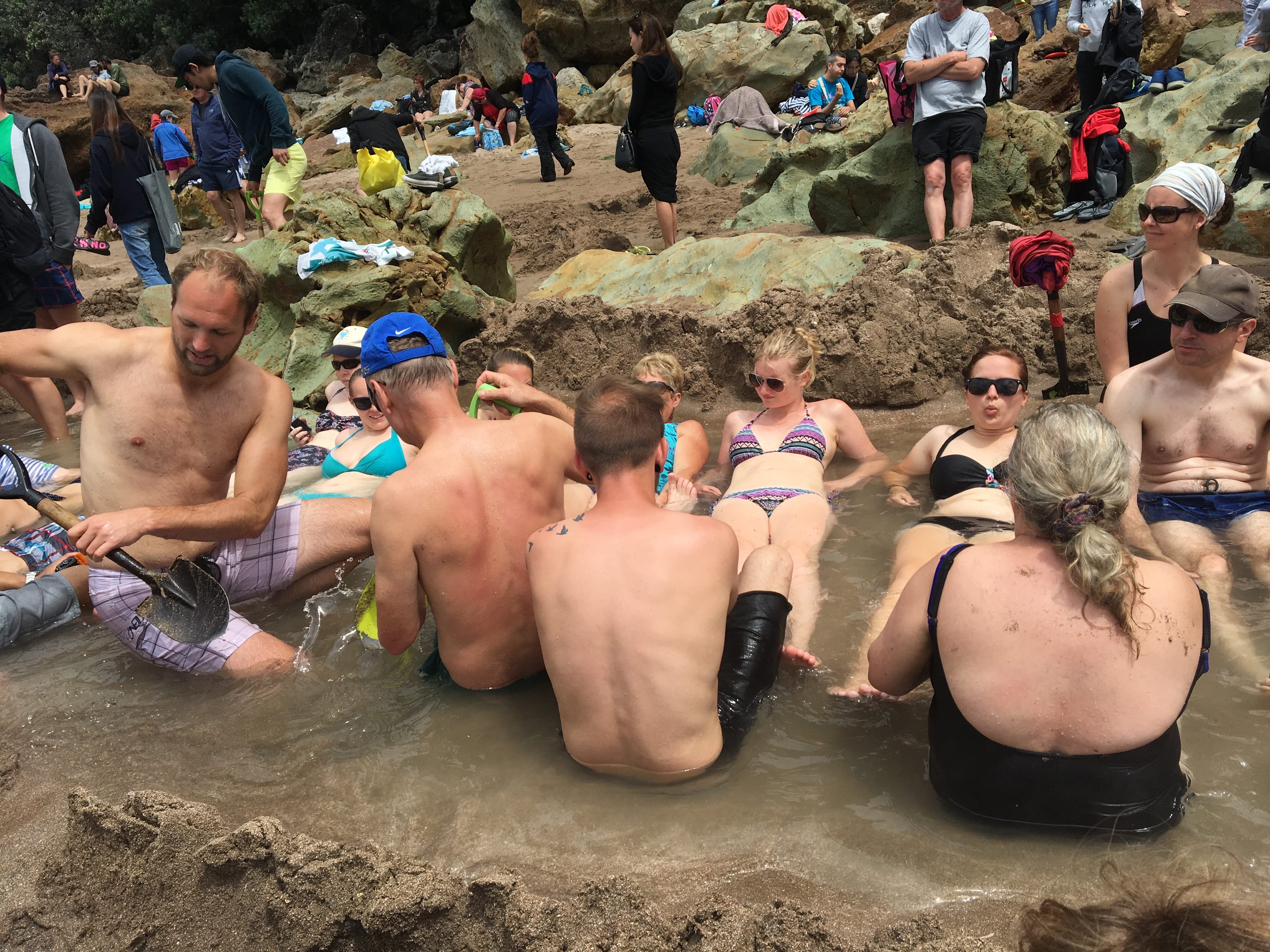
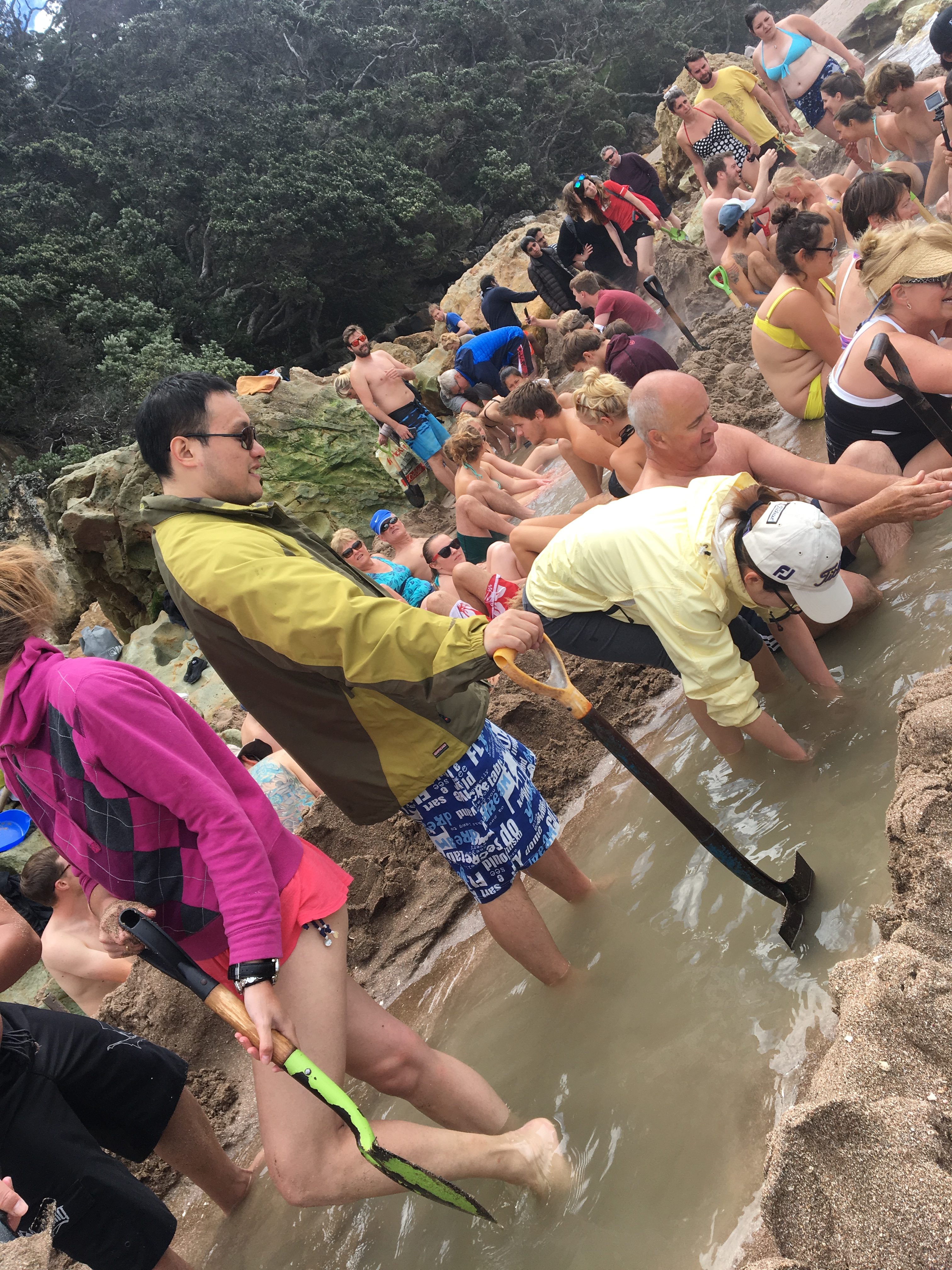
The local knowledge told us to arrive at the beach near low tide with shovels and some energy to dig. Once the right spot is located, start digging, they said.
Rather than searching for treasure, we were on a mission to build our own hot tub.
At Hot Sand Beach on the Coromandel Peninsula, there are two spots near the rock outcroppings where naturally heated water flows through the sand. Just dig down a few inches, and the hole will fill with hot water.
We got there on time but the place was already crawling with other hot tub enthusiasts. Those in the know were knee deep in a decent tub. Those with poor information were wearing confused looks as their holes filled with water, but it was cold.
We started digging with a couple on their honeymoon. Never got their names. A few cold holes abandoned, we moved over near to the group who seemed to have the location right. They were already lounging. A group of us started digging nearby and made progress until a big wave came in and took out our retaining wall. That happened three or four times before I was over it.
I’ve never been a huge fan of sand, but I’m a more-than-huge fan of hot tubs. I thought one affinity might supersede another aversion. Nope. Once covered in sand, sticky from the salt water and tired from digging, I was ready to leave behind the sociology experiment.
A few weeks later I learned from a local that the hot water beach used to be a quiet spot where a small group of diggers could have the whole place to themselves. Nevermore.
Richard and the third retaining wall.
The Haves enjoying their tub while the rest of the beach works to copy their engineering and syphon off resources.
An abandoned project after it was discovered the water inside would only ever be cold.
Hi Everybody! Apologizes for the delay in posting. A lot of logistical changes have happened in the last six weeks — including a long wait for our Internet connection. Thank you for all the well wishes and check-ins after the Kiakoura earthquake. We are fine and were not directly affected by the quake.
When it hit, we were up in Hamilton (about a 4-hour drive from our house in Whanganui) and asleep in our camper van. Richard felt the shaking first, which was more like rocking on the rubber tires.
He woke up and said, “What is that?”
I didn’t hear him. A few moments later I woke up and immediately whipped my head around to Richard. “WHAT are you doing?!”
“Umm. That’s not me. I think it’s an earthquake.”
We pulled the curtains back and squinted out the window at a 15-meter tall pine tree which looked like it was caught in a wild wind. I was surprised by how long the earthquake lasted. I’ve only been in a couple quakes and I remember them only lasting 15 seconds or so. This one just kept going. Which makes the damage done at Kiakoura understandable. The photos of road damage, seabed rise and train tracks that shook themselves across the road are impressive.
The next day, we talked with a friend whose family has lived in Hamilton for 40 years and she said she’d never felt an earthquake in Hamilton before.
We drove back to Whanganui without coming upon any damage. Wellington seems to have sustained the most damage on the north island.
We’ve also received messages of concern about tsunamis in our area, which are possible, but rare.
Research published this year documents evidence of three or four large tsunamis hitting the east coast of New Zealand in the last 1,200 years. The Whanganui District redistributed tsunami warning maps right after the quake. Our house is in the “yellow zone,” which is the third tier of severity if a substantial tsunami were to hit. Fortunately for us, the house 200 feet further upstream of the Whanganui River is outside of any warning zones. So, we’re right on the edge of current damage data.
There are two tsunami sirens that are set to go off in the neighborhoods closest to the ocean. We’re about two miles from the nearest siren location, so I don’t know if we’d hear it. But we’re also far enough inland that our chances of imminent danger are low.
According to the Whanganui District’s website, “the most tsunami-prone areas in New Zealand are between East Cape and Napier, the Cook Strait area, the area around Banks Peninsula and the East Coast of the South Island.”
None of those locations is very near us. The District does have record of tsunamis in Whanganui in 1868 and 1922. So, maybe we’re due. (Just kidding, moms.)
It took about three weeks for the psychosis to really set in, but here it is! Richard and I are obsessed with eating kiwi fruit.
The last time we were in visiting this country, we discovered the wonder that is New Zealand-grown kiwis. The fruit originated in China where it was picked from the wild and was first commercially grown in New Zealand in the early 20th century. According to the Center for New Crops & Plant Products at Purdue University, the fruit became popular with American serviceman stationed in New Zealand in World War II and it started to be exported to the U.S. after that.
We both grew up eating kiwis on occasion. They were a tangy treat, usually firm from their trip across the Pacific Ocean. We were eating Fuzzy Kiwifruit. There are many varieties of the plant, but the type with a furry skin and green fruit are most common in the U.S.
These are also very common in New Zealand, along with kiwi berries — green, grape-sized fruits with thin, smooth skins and green flesh; they taste similarly to fuzzy kiwis — and golden kiwis.
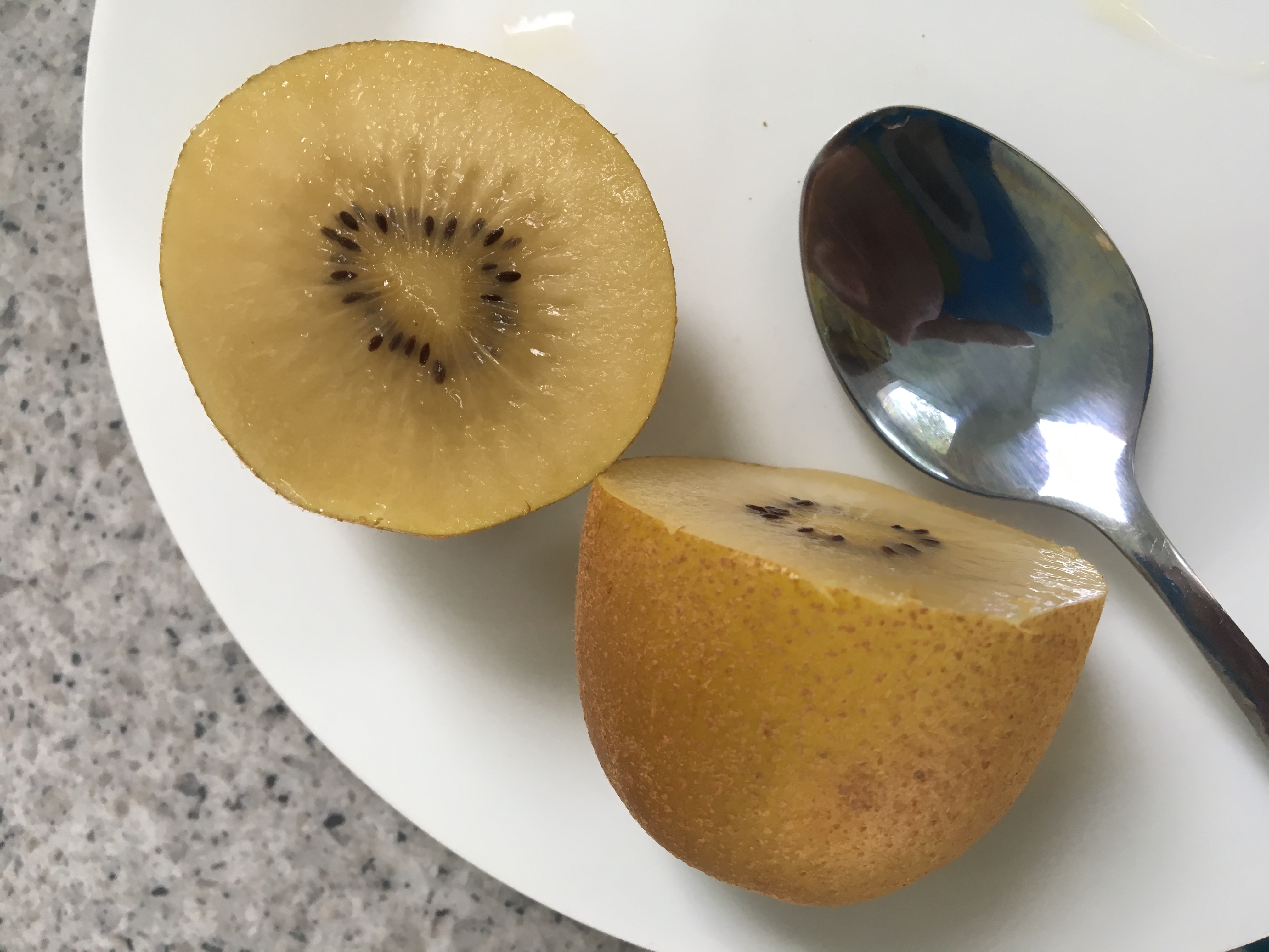
Golden kiwis have a bronze, smooth skin and green to yellow flesh. They taste sweeter and have a stronger scent than fuzzy kiwis. But, they have a shorter shelf life and so have not yet made the leap across the Pacific for commercial sale.
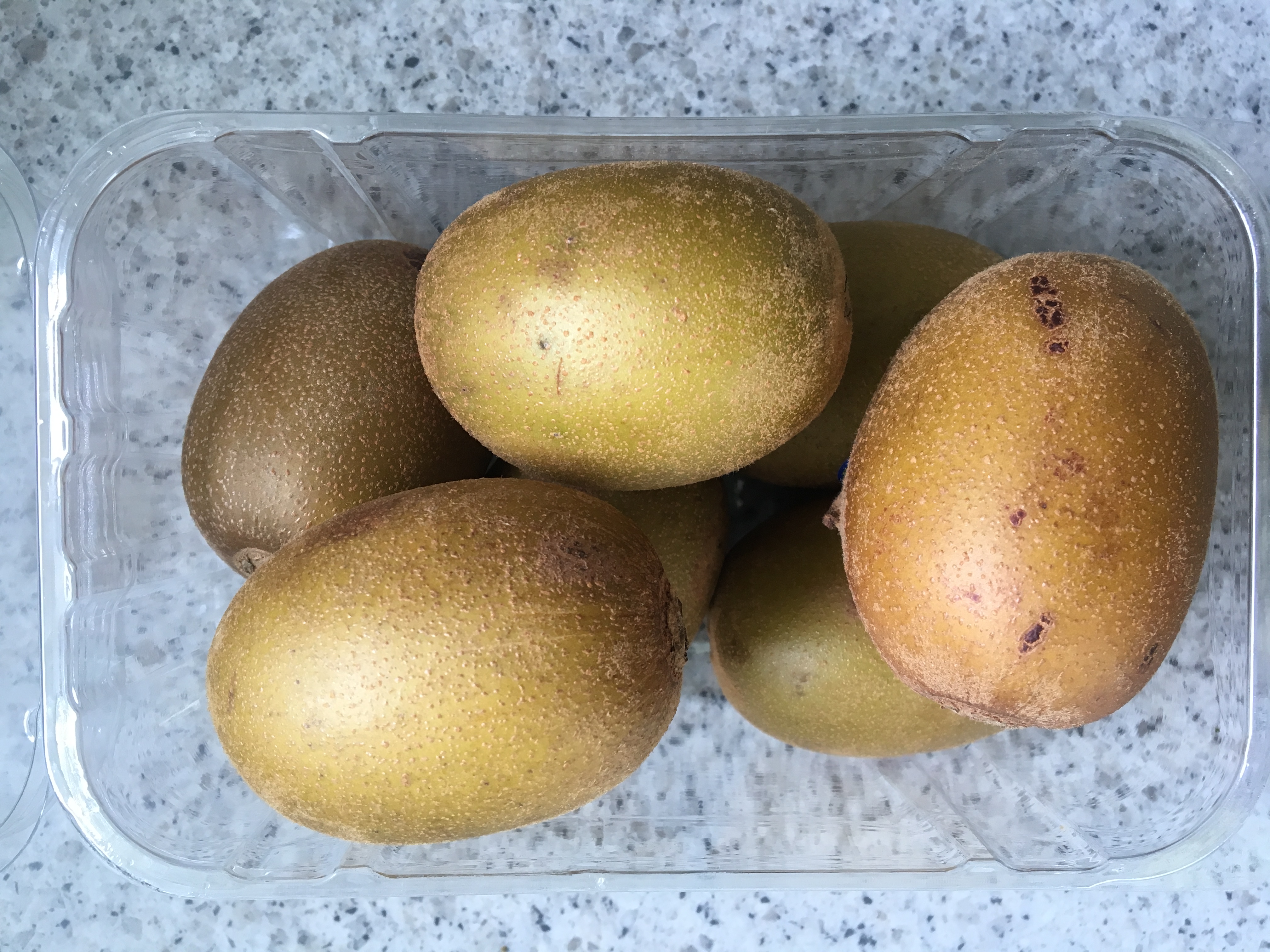
It is these golden kiwis which have taken over our diets. Numbers that lasted us a week when we got here, now last only a day.
They’re awesome and I can’t recommend them highly enough!
A day’s worth of golden kiwis.The clear yellow fruit of the delicious golden kiwi.
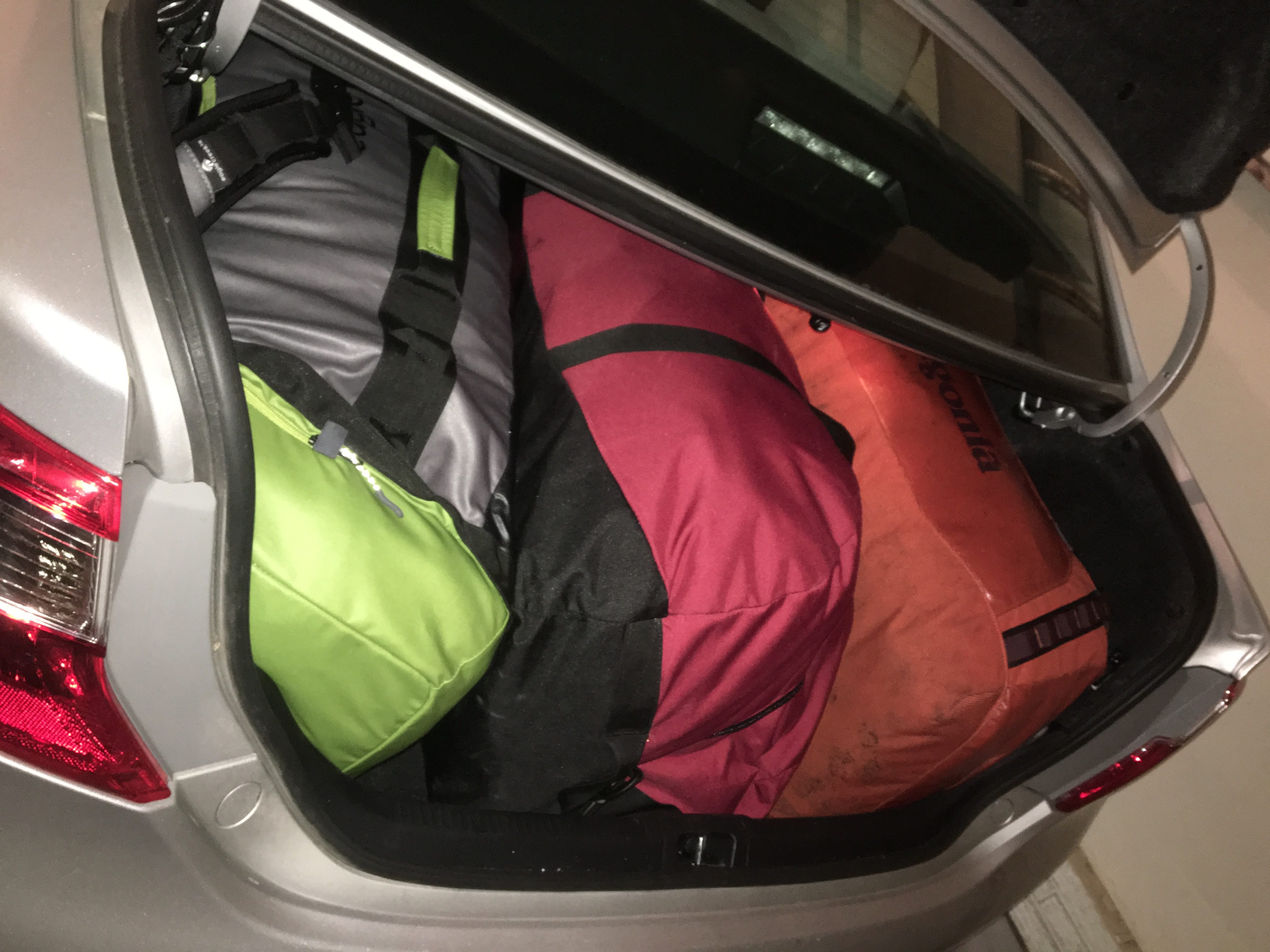
Less than a month after finishing the PCT, Richard and I packed 280 pounds of stuff into four very large duffel bags and flew with them to New Zealand.
I can fit into each of these bags when they’re empty.
The plan is to live and work in Wanganui, New Zealand for the next year. We’ll use any time off to travel the country and explore what it’s like to live in this hemisphere with a little more access to the world than we had in Antarctica.
I’m still in the process of learning all that needs to be done to become a participating member of the Wanganui community and the New Zealand country, so those insights will come once I’ve wrapped my head around them.
After a long flight (made longer by the cancellation and rebooking of the leg across the Pacific Ocean), we landed in Auckland at 7 a.m. on a Thursday. We spent the next couple of days covering the logistics of moving to a new country. Bank accounts, tax ID numbers, address verification, buying a campervan, buying a new phone plan, adjusting to a new time zone, trying not to hurt anyone or break any laws while driving on the left side of the road, etc.
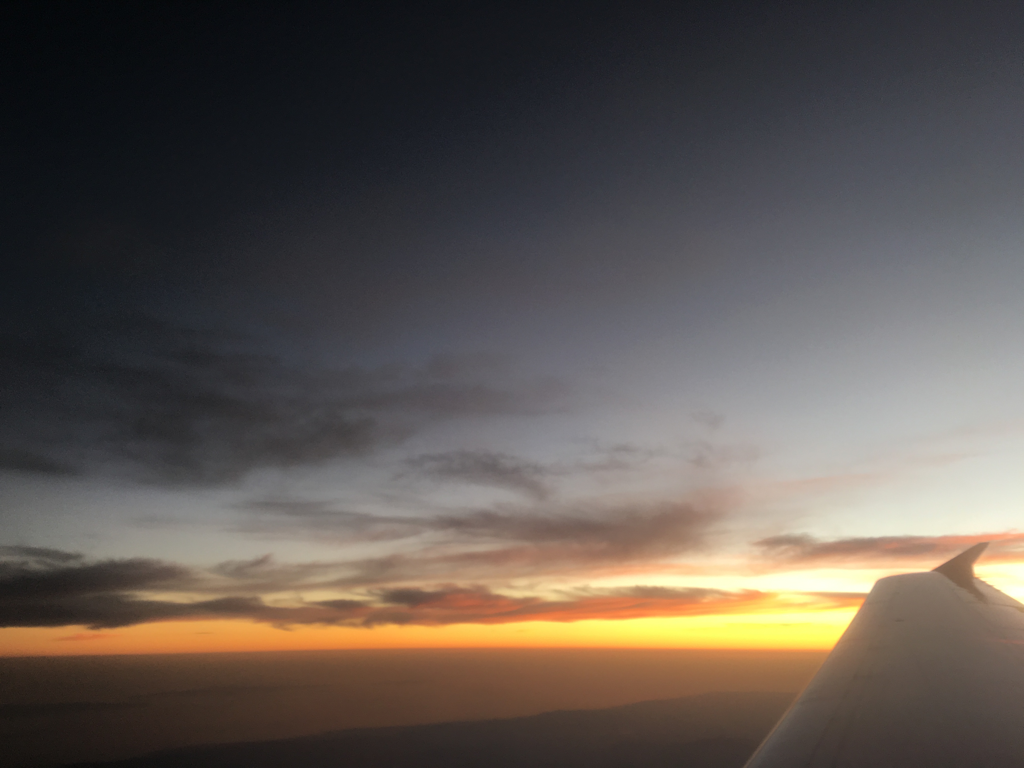
For the last couple of weeks, we’ve been enjoying getting to know our new town and taking in the many beautiful sunsets.
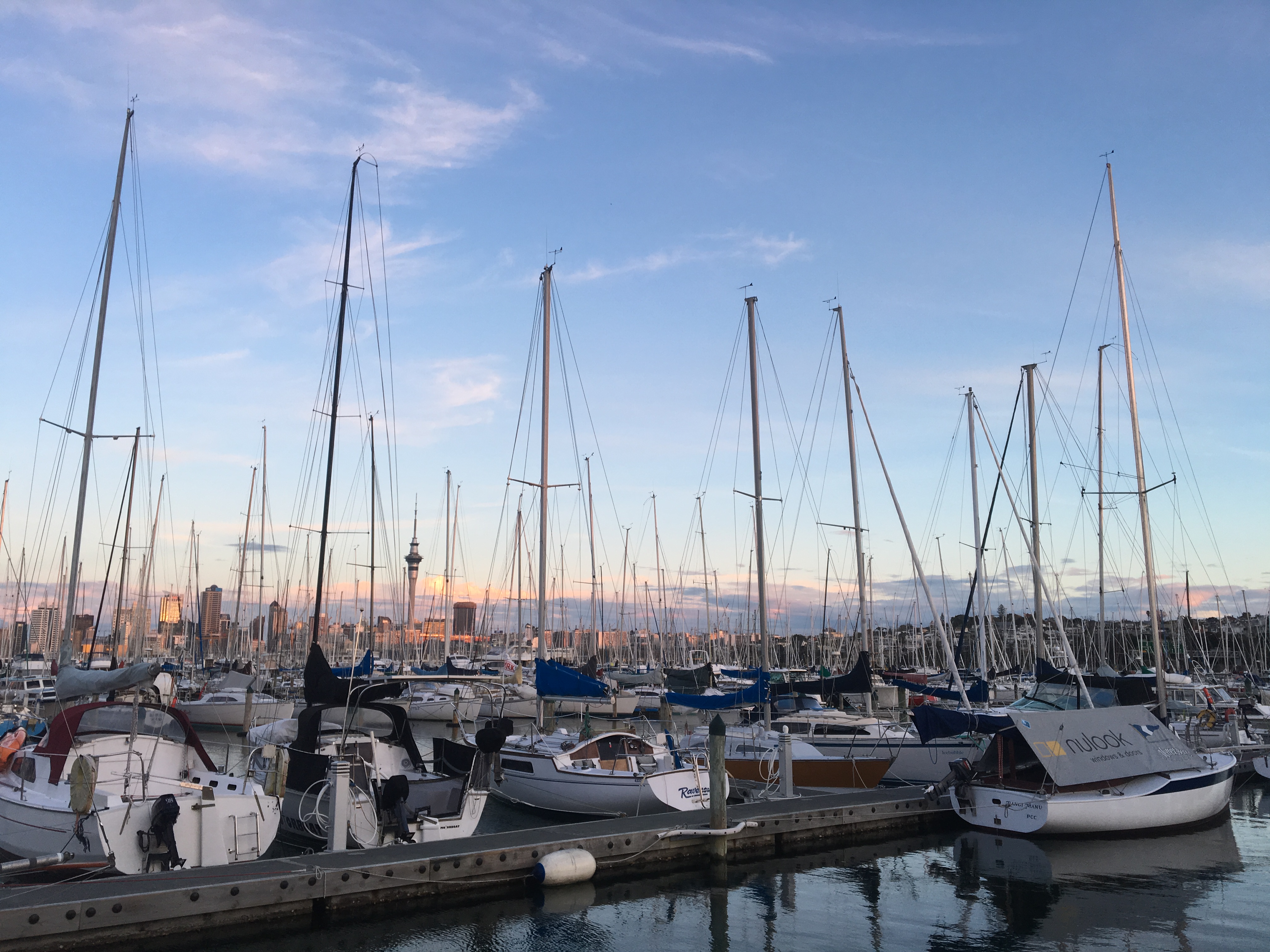
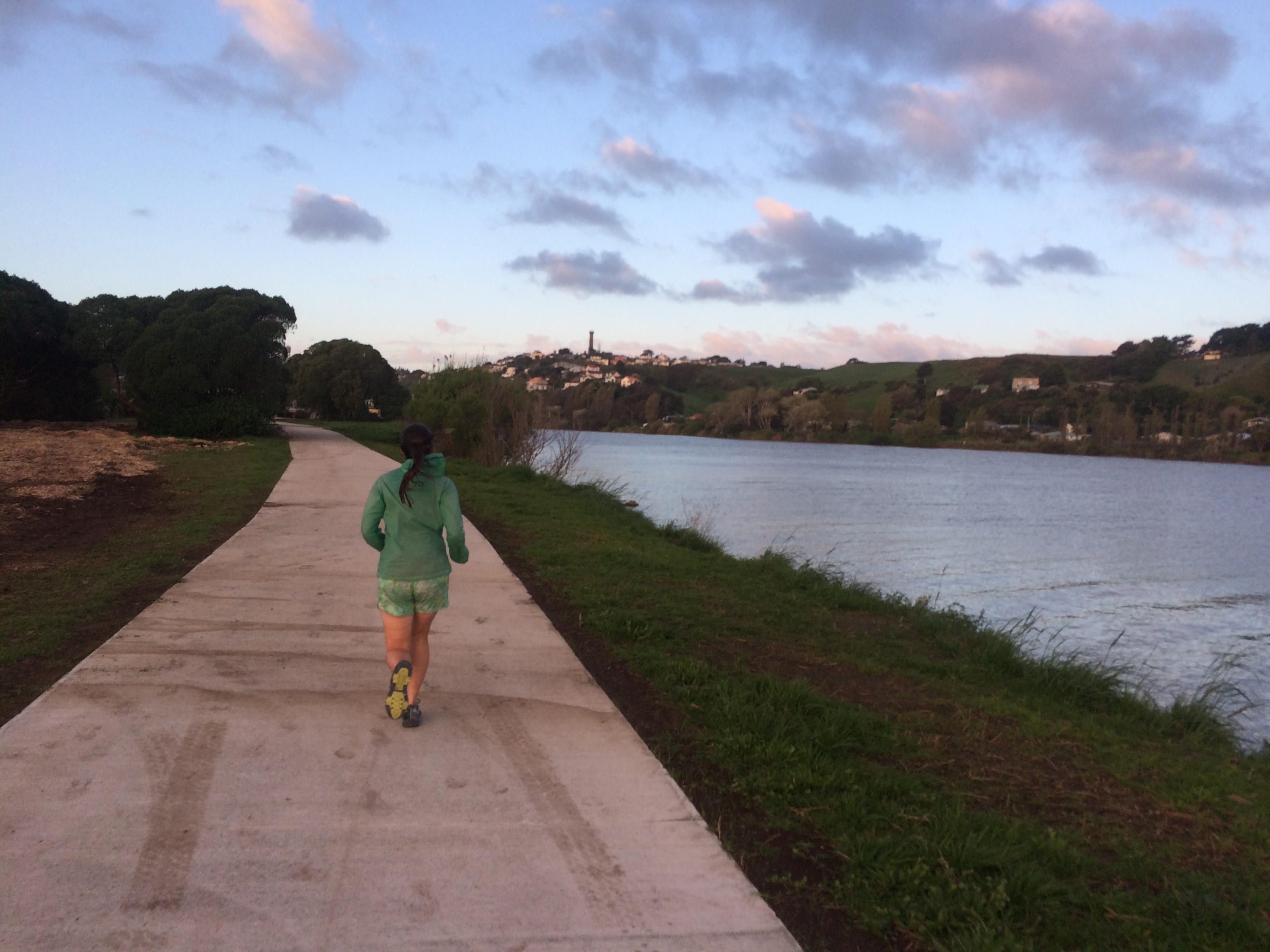
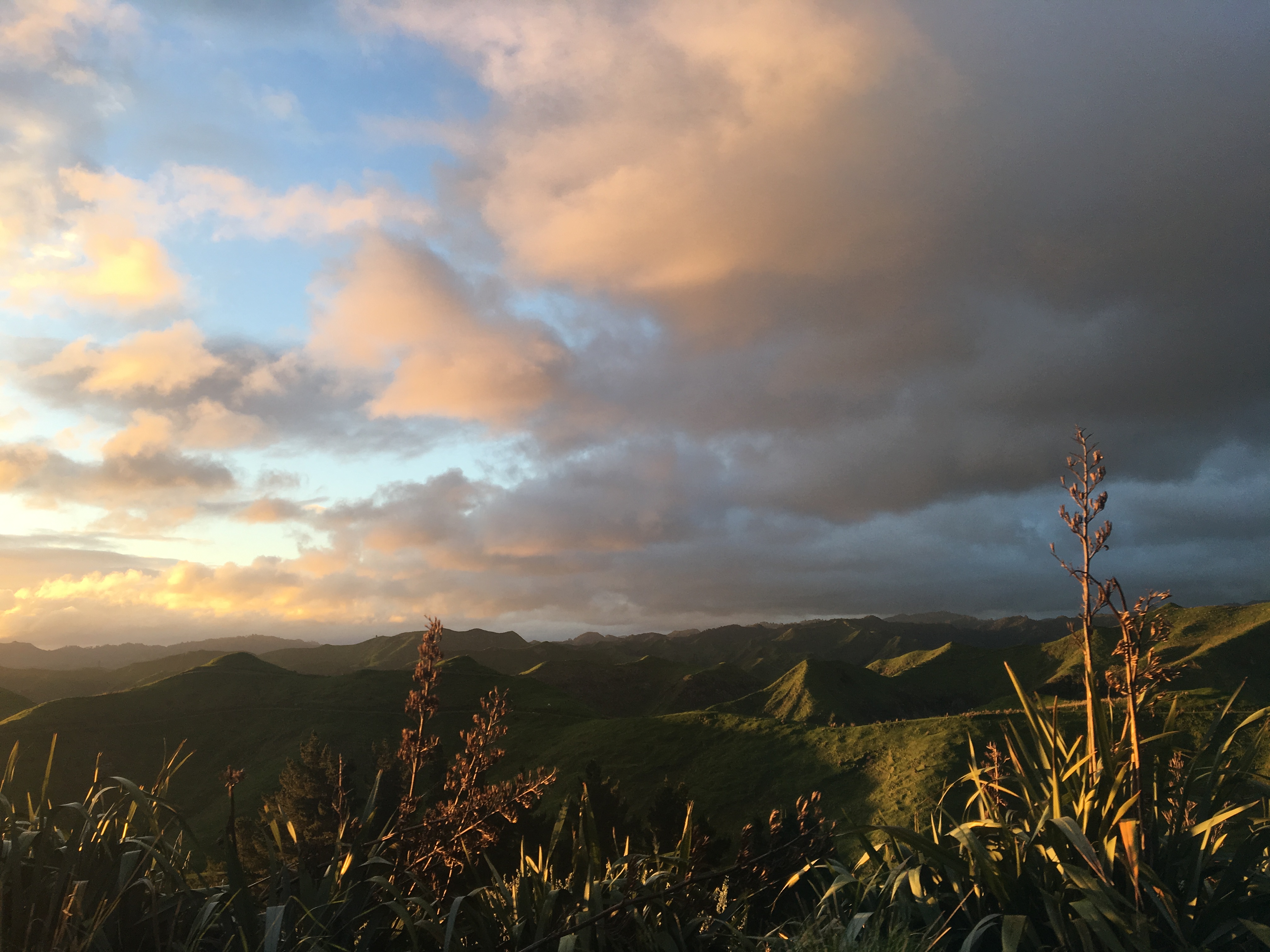
Airplane sunset.Auckland boat sunset.Running along the Whanganui River sunset.Driving in the farmlands sunset.
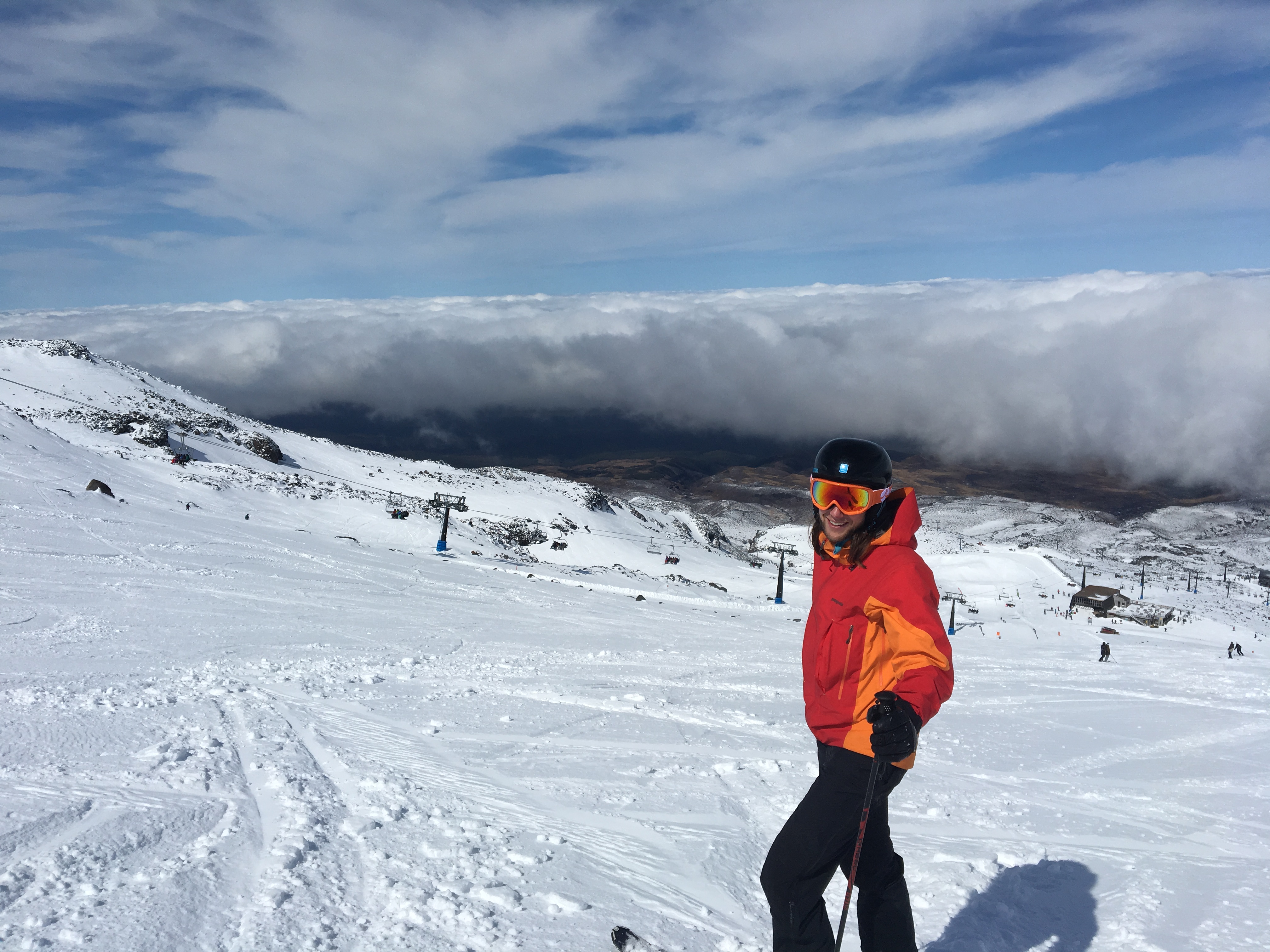
As it is still spring, we decided to get in some spring skiing before it all melts away for summer.
Richard on the Turoa slopes on Mt. Ruapehu.
The snow turned to mashed potatoes by noon, but we had fun on the short skis they use down here.
It was a cool, wet morning. The rain stopped, but every fern and bush was dripping. We spent the morning chatting and the miles seemed to fly by.
Three other hikers joined our campsite the night before, so we were all pumped, and yet contemplative, about getting to the border.
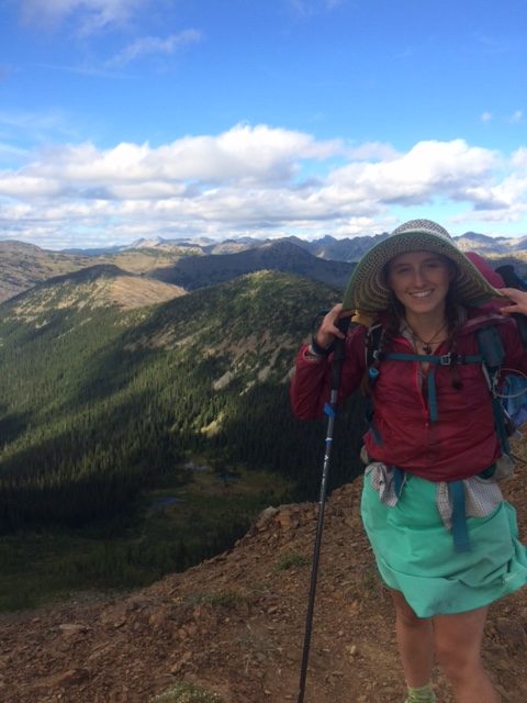
Upon arrival, we all dropped our packs and sat around chatting and drinking coffee for a couple of hours. It was a nice opposition to the end of my Appalachian Trail thru-hike. That morning, Richard and I hiked up the exposed rock into a wet, cold storm. We spent maybe 60 seconds at the top taking a quick photo. Then it was straight down before the hypothermia set in.
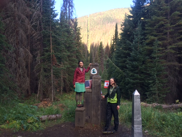
The PCT ended a little chilly, but overall very pleasant. By the time Richard and I shouldered our packs, about 10 of us had finished.
As we hiked toward the civilization in Manning Park, the temperatures rose and we shed our layers.
At the hotel we showered and laundered and ate. We caught the 2 a.m. bus to Vancouver and then another from Vancouver back to the states.
With the PCT completed, we have now finished three of the four big steps in our travel plan. The PCT, Antarctica and the bike ride. The last step is planned and we’re in the finishing touches of executing it.
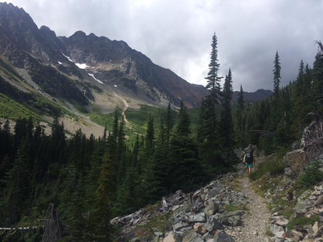
Like I said, you never know what the mountains will bring. Most of the day was warm and sunny. But as we crested our last PCT climb, we saw a storm a few ridge lines over. As we walked, it came toward us, making every ridge in between disappear until it was on top of us.
It had been a chilly night, so we got a later start because the first 30 minutes of the day were spent in our sleeping bags, avoiding the chill of the morning.
Once we got moving, it warmed up as soon as we got into the direct sun.
We met a ranger today. He was the first (and probably only, seeing as we’re 4 miles from the border) ranger we’ve ever seen anywhere on the PCT.
I was so surprised to see him that as Richard hiked up behind me, I pointed at the ranger and said to Richard, “look, a ranger.” They are the rarest of species out here.
He was nice and we chatted about solar panels.
The rest of the day, the ranger was all any of the hikers could talk about, as he stopped us all to chat while he tallied our number in his notepad.
He told us there would be a 20 percent chance of rain tomorrow. With the rain we had this afternoon, I’m hoping that was the precipitation predicted and it just came a little early.
We’ll see. We’re hoping to take a break at the border at enjoy the moment a bit. But if it’s raining, I will be less inclined to just hang out without cover. We’ll see.
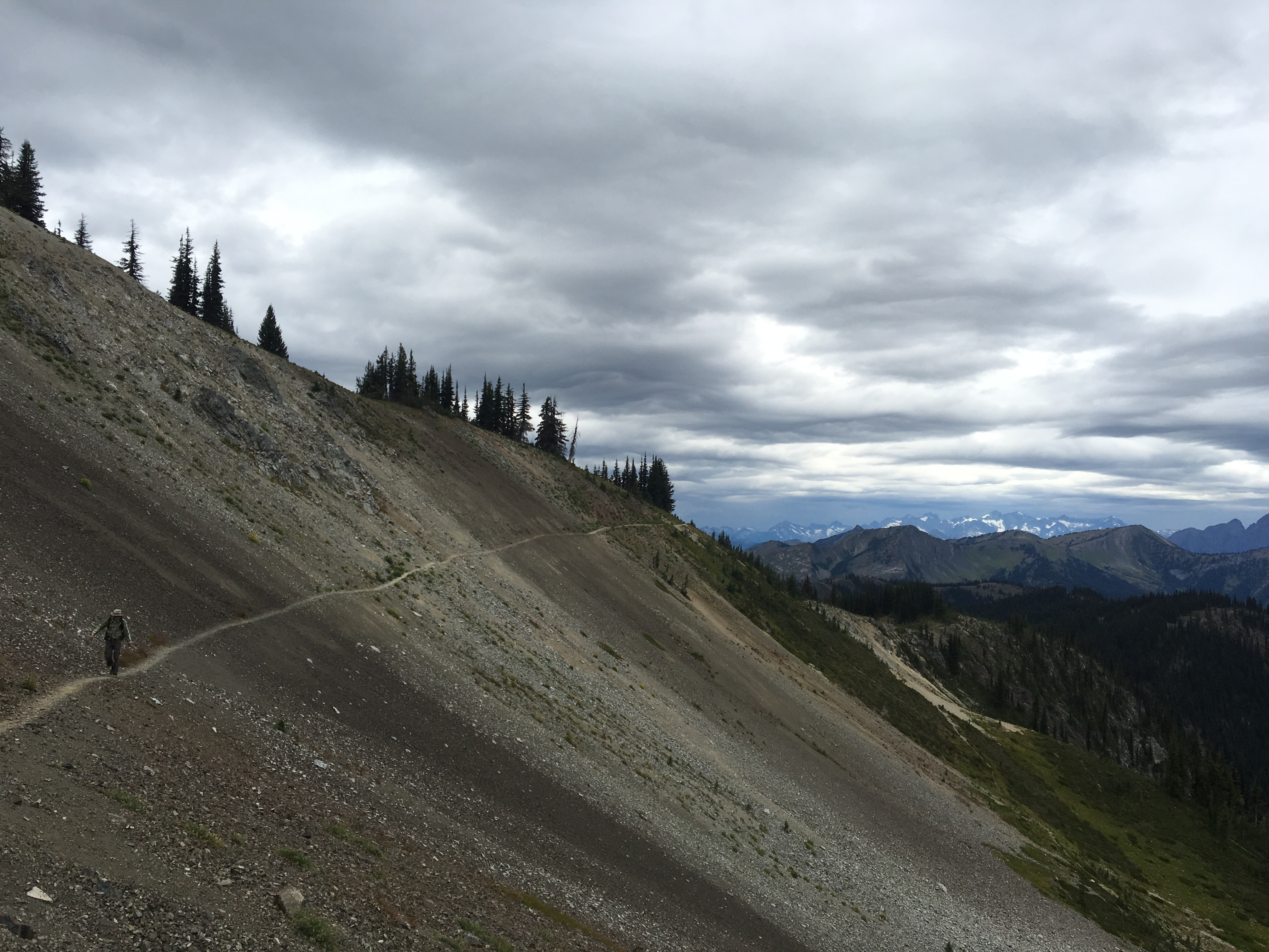
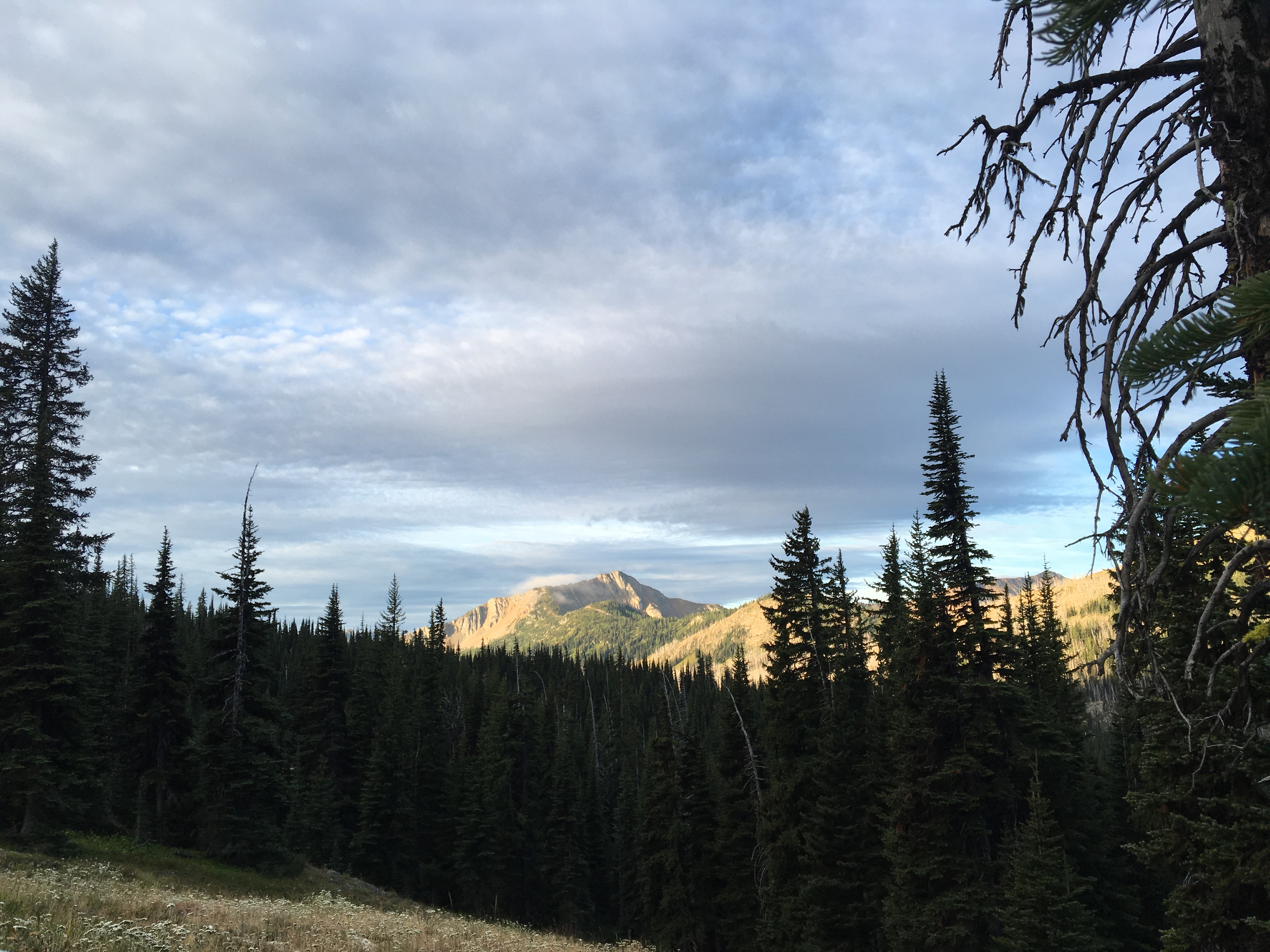
Pasayten Wilderness.Moody clouds.Morning light to the south near Harts Pass.
It was our biggest day yet and as far as my feet were concerned, it was a twenty-mile day.
It only took 480 miles but it seems my feet have finally settled in to hiking. And it’s less than 40 miles to the hotel in Canada where I will stop hiking. Oh, feet.
The weather forecast suggested rain today, but we only got a few sprinkles. There were clouds that could have carried rain above us. But only sunshine reached us.
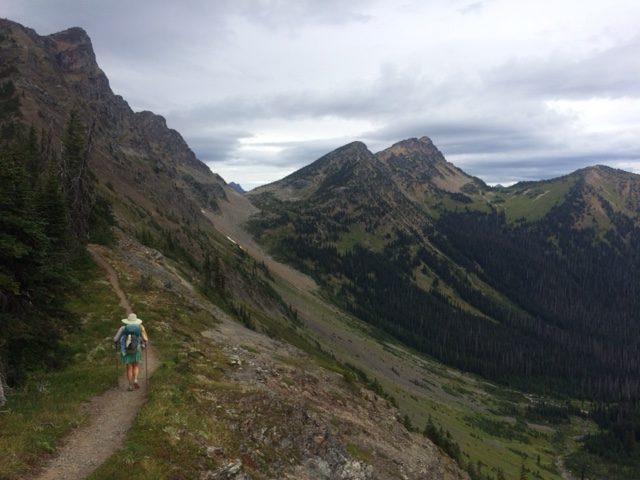
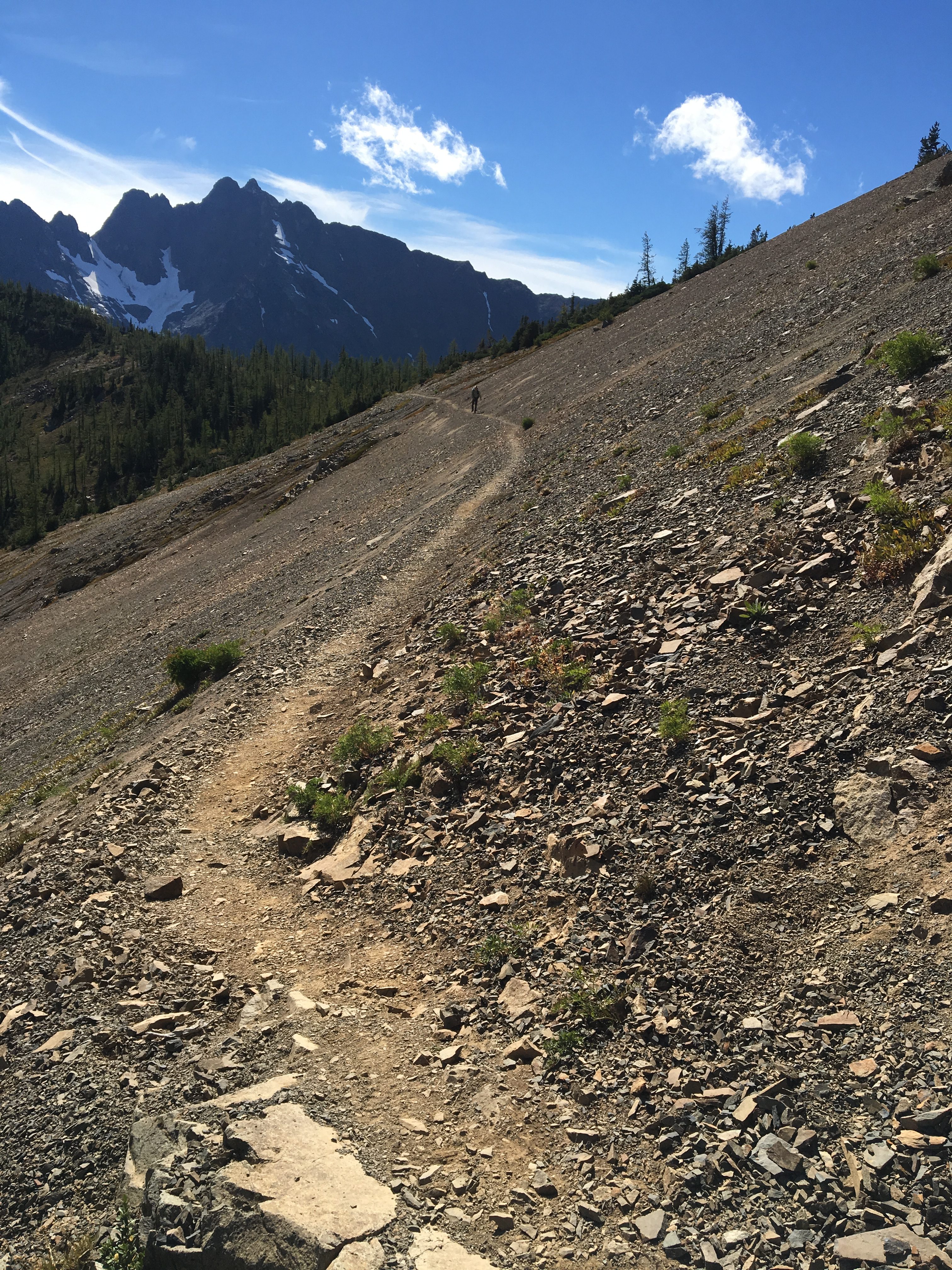
After a five-mile climb over Cutthroat Pass, we went down for the rest of the morning. A solid afternoon climb took us back up around 6,000 feet and there we stayed. Most of the next 25 miles are up high.
The views today were vast and craggy. The ridge to the south this afternoon was cut in half by an old forest fire with charred earth to the east and lush green trees to the west.
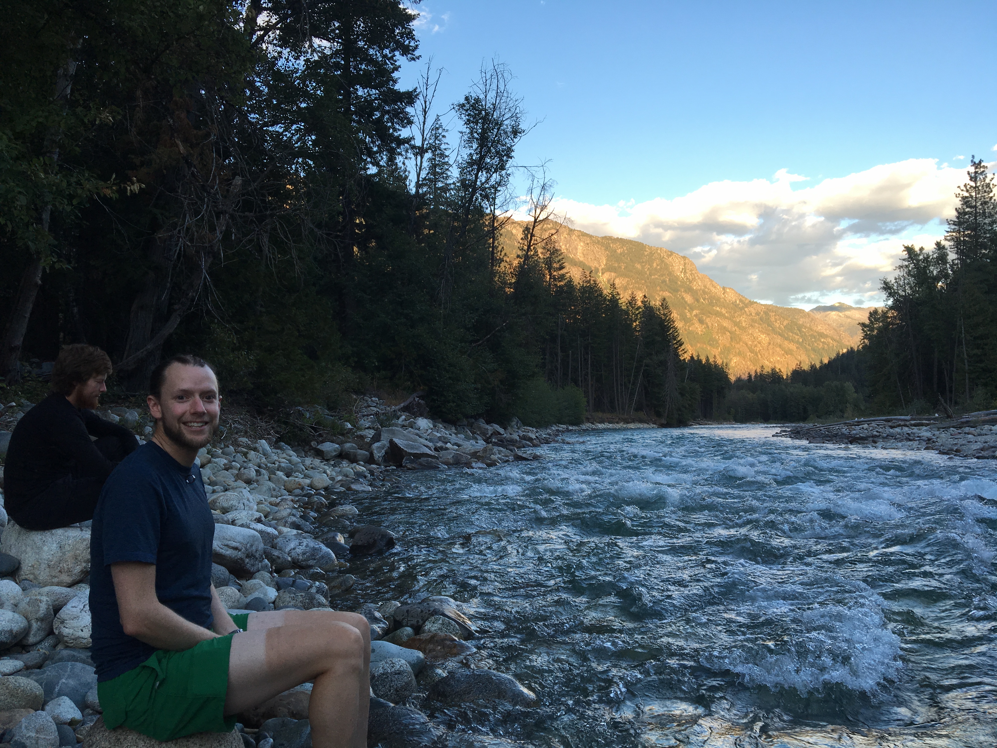
We ate dinner by the last reliable water source for 20 miles. It’s strange to have such a long water carry in Washington. This state is known among hikers as a wet walk. We’ve had almost no remarkable weather to speak of. But that’s fine with me. And we have two days left, so anything could still happen.
Richard says the most exciting thing that happened today was when we were buzzed by a peregrine falcon going what I can only guess was near its top speed of 120 mph in a full dive for some prey. We mostly heard it go over us and barely saw the brown blur. My first thought was bear!? Because that’s where my amigdala goes first when out in the woods. Richard thought it was a tiny brown jet because that’s really what it sounded like.
And while that was really cool, I thought the most exciting thing today was that my feet didn’t hurt. Potato/potaato.
A cooler morning on the ridges.Hanging onto my hat.Richard walks north from Grasshopper Pass.
Breakfast started at 7 a.m. and we were ready and waiting. There was eggs and granola and yogurt and potatoes, but I filled up on the delicious homemade biscuits.
After breakfast we gathered our packs and caught the bus back out to the trailhead.
It was another hot day and a few miles in, the fact that we were showered and wearing clean clothes was no longer noticeable.
We spent the whole day walking uphill. The twenty miles coming into Stehekin were downhill and now we were paying for it.
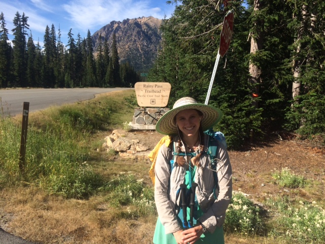
Around 4:30 p.m., we crossed Route 2 at Rainy Pass. This was the first big climb of our cross country bike trip this summer. On the morning of our fourth day on bikes we crested Rainy Pass. And on the evening of our fourth-to-last day of our PCT hike, we crossed it again.
When I was in high school, I would spend a week every summer at my aunt’s house in Alliance, Ohio. It wasn’t just any week. It was always planned around the Rodman Public Library book sale. The majority of my book acquisition up to that time came from the book sale. I loved volunteering in the fiction room where it was my job to open up all the boxes of new-to-the-sale books and put them out on the tables wherever there was space. That gave me first dibs on the books and I had a stack of hundreds of books that came home with me each year. It was the freaking best!!!
But the first year I volunteered, they didn’t put me in the fiction room. Instead, they stuck me in magazines. It was a bit of a slight, but I made due and it ultimately sparked my love affair with magazines, something I continue to this day. And it was at my first book sale in the magazines that I found an old copy of National Geographic from 1973. I chose it because it had an article about Charles Dickens featured inside and after my first trip to the United Kingdom a few years before, I became a committed Anglophile. But toward the back of the issue I found something that captured my imagination and I’ve never forgotten it. It was a photo essay about life in a tiny mountain town in Washington state. This town is inaccessible by road. The only way in or out is by foot, water or air. I knew this town and I would match and I have dreamed of the day I would get to visit it.
And that same enchanted (for me) town is where we hiked for our last resupply on the PCT.
We woke up on time and got on the trail before 7 a.m. The bus into Stehekin proper (yes, there are roads within Stehekin, just not TO Stehekin) would arrive around 9 a.m. at a ranger station about 3 miles away from where we camped. While I usually takes us just over an hour to cover that distance, we elected for an early arrival just in case. And when one of your childhood dreams is about to come true, it’s hard to sleep in.
We got to the bus pickup early, duh, so we wandered around the ranger station reading signs and marveling at the blue-green water of the Stehekin River, which flowed past us.
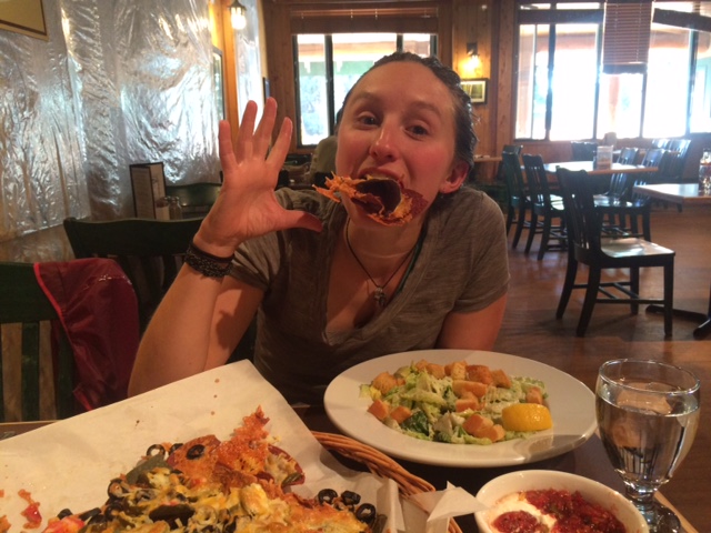
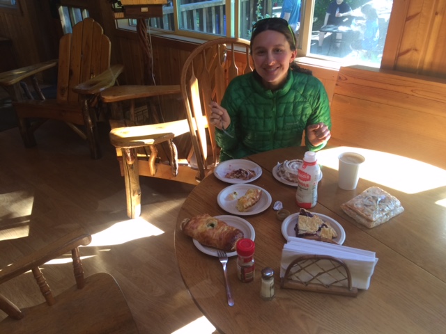
The bus came and we asked to be dropped off at the bakery, please. The Stehekin Bakery is renowned on the PCT. Ask a southbounder you pass in California what to know about Washington and they will say the bakery in Stehekin. We arrived and promptly bought about 5,000 calories. A cinnamon roll the circumference of a salad plate; a raspberry almond Danish; two pesto, onion, mozzarella stuffed loafs; a slice of mixed berry pie; vegetable quiche; three slices of pizza; a chocolate chip cookie; and a coffee, of course.
I know we’re hiking and very hungry, but this food was amazing, you guys!!!!
We sat there for a couple of hours just eating.
After we’d overfilled our stomachs, we decided to walk the two miles into town rather than wait for the next bus. That lovely decision took us right past “The Garden” and Carl. Carl has a beautiful vegetable garden from which he sells picked to order produce. We admired his dahlias while he brought us carrots, peaches, cherry tomatoes and some homemade goats milk banana lassi.
As we got into town, everything we needed was right there. We booked a cabin at the Stehekin Valley Ranch for the next night, got our room at the Stehekin Lodge for that night, got our resupply box from the post office, showered and then headed to the laundromat to do our very dirty laundry.
We had dinner at the Lodge and sat through two lectures put on by the National Park Service at the North Cascades National Park visitors center right next door to the lodge.
Then we went to bed.
The next morning, we ate our bakery pizza slices for breakfast and then caught the bus out to the Ranch.
Because the ranch is so far away from everything, you get three meals included in your stay. We made it there just in time for lunch.
Then we lounged about for the afternoon and lamented multiple times how long it is from 1 p.m. to 5:30 p.m. when you’re hungry and ready for dinner.
At dinner, we sat with a group of PCT hikers and spent the whole meal laughing.
Then it was time for bed.
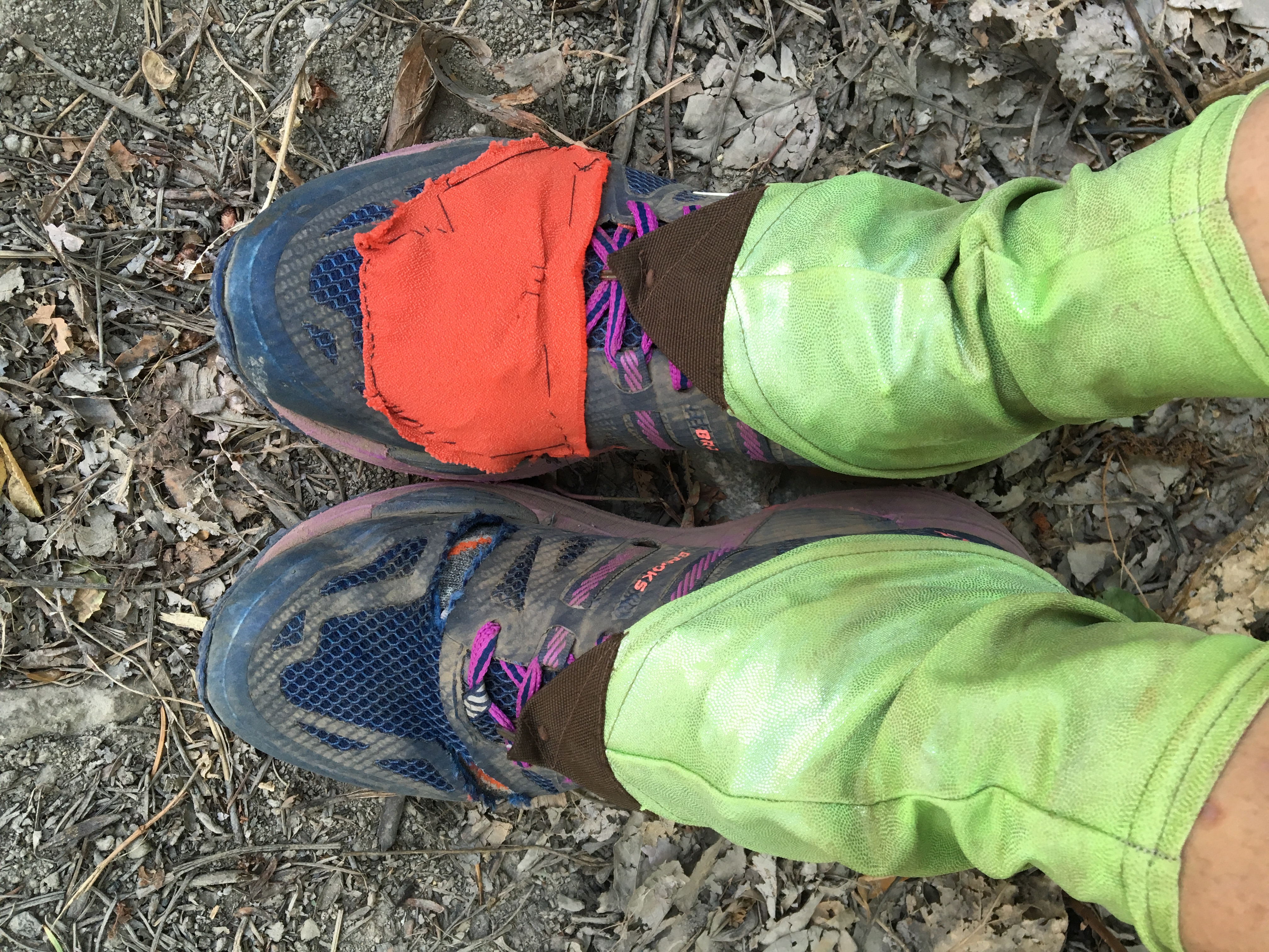
Stehekin Bakery!!Richard along the Stehekin River.I sewed some fabric over the latest stitching to keep out sticks and pine needles and rocks.